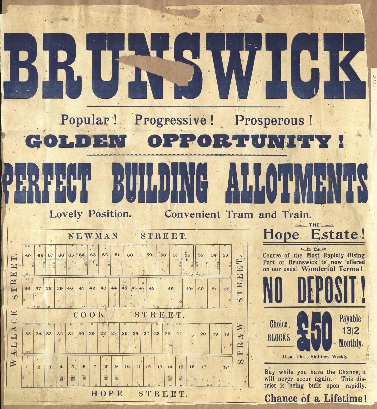
Brunswick and Brunswick West Unrestored
Step back in time with our collection of raw historic pieces, each one a potential candidate for digital restoration, printing, and framing. Should you find something captivating for your home, simply place the custom order through our Custom Order Product with our online store. Just copy the title below the desired item, and the listed prices already include the restoration fee. For further inquiries and customisation options, don't hesitate to reach out to us via our Contact form.
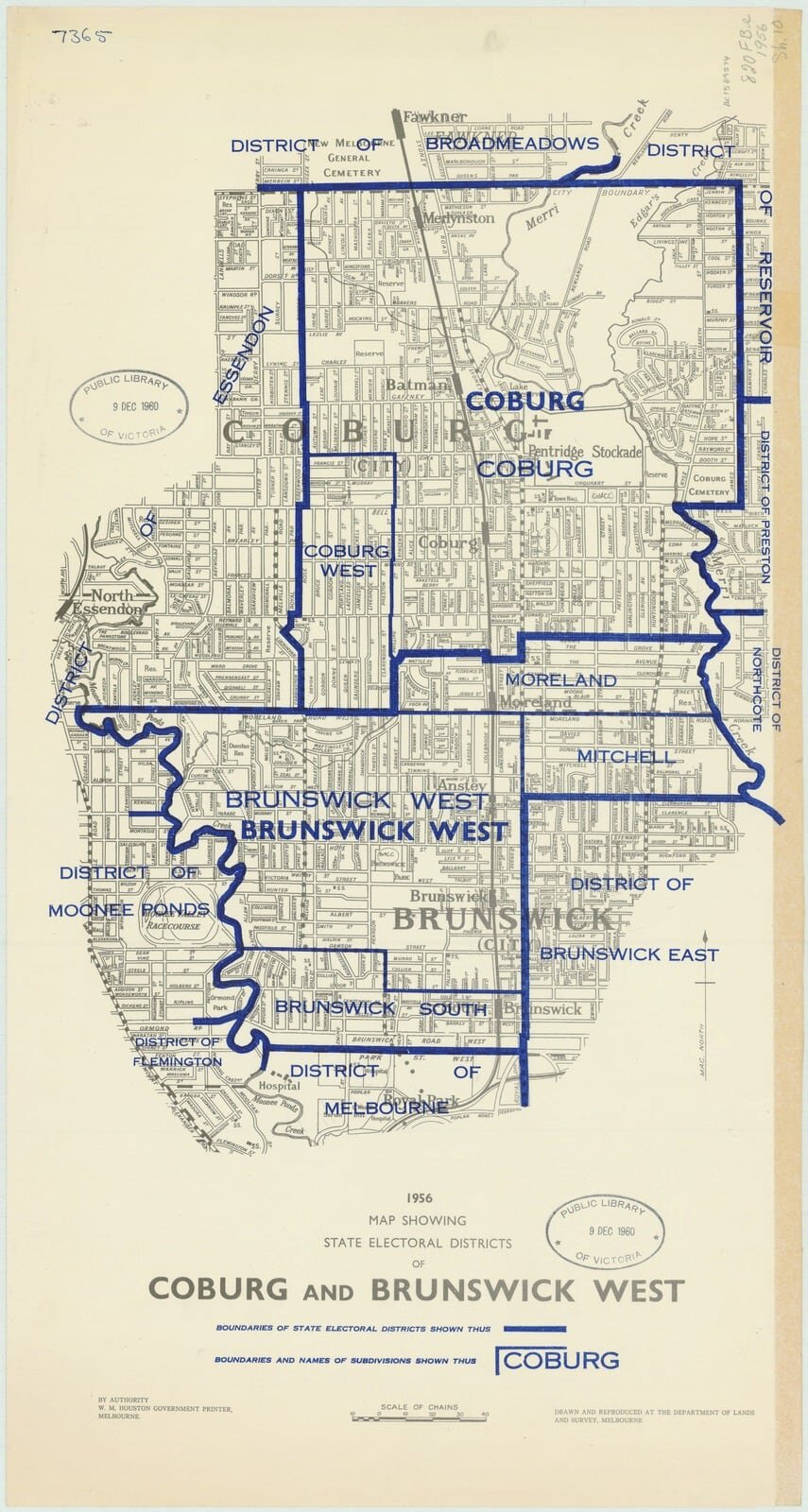
1956 map showing state electoral districts of Coburg and Brunswick West

1956 map showing state electoral districts of Coburg and Brunswick West drawn and reproduced at the Department of Lands and Survey.

1852 Plan of the Parish of Jika Jika in the County of Bourke
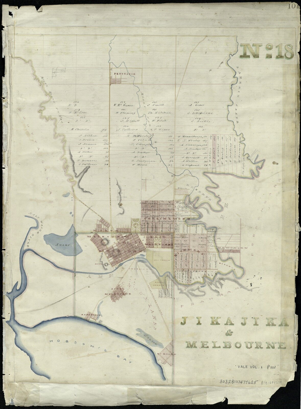
Jika Jika Surveyor Generals Office 1856

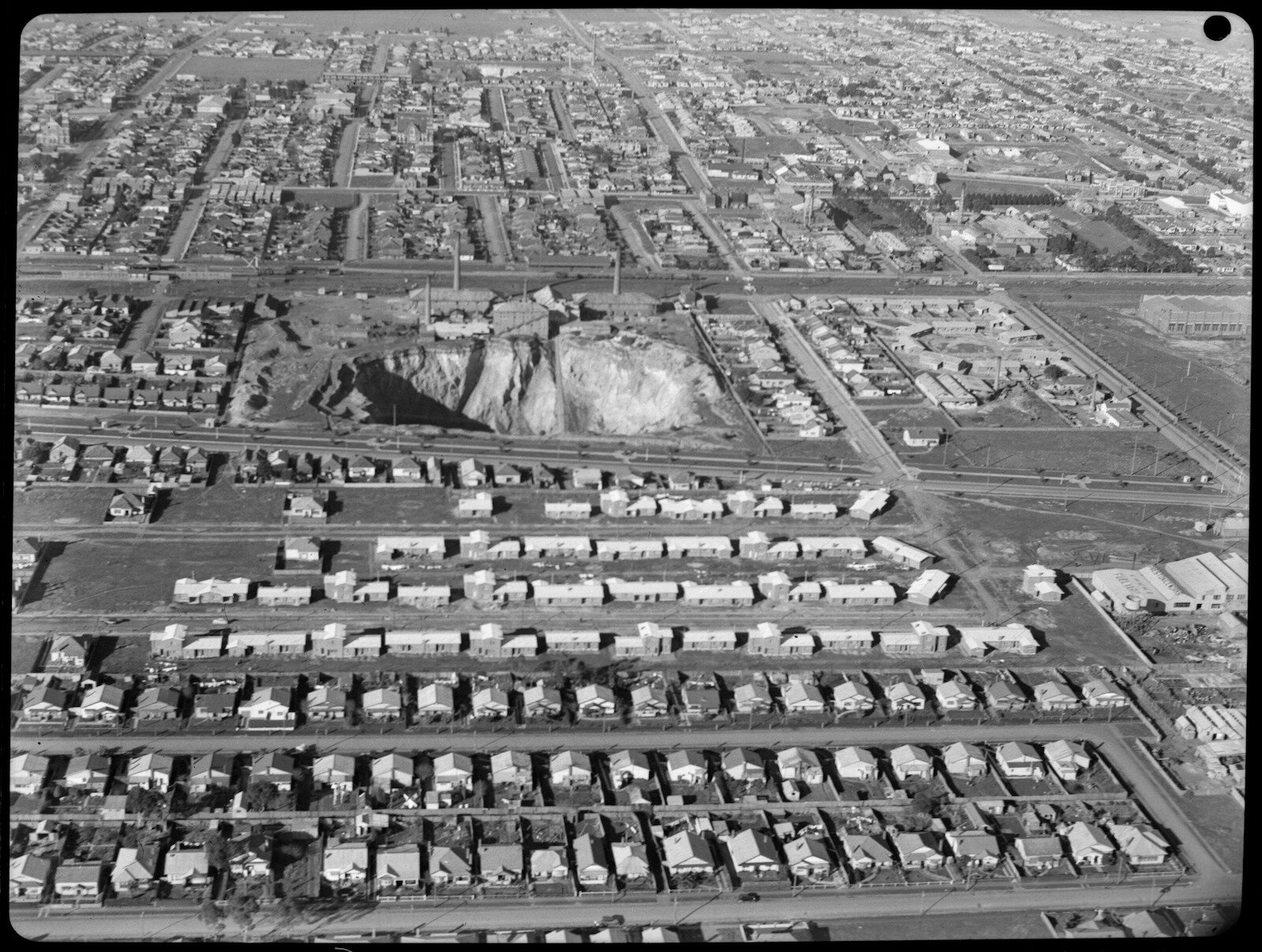
Aerial view of Brunswick 1940-50 - probably Brunswick and Coburg, showing probably Hoffman's Brickworks in the centre
South Brunswick looking E. along Heller St. Brunswick Rd. & Park St - Parkville on far right.
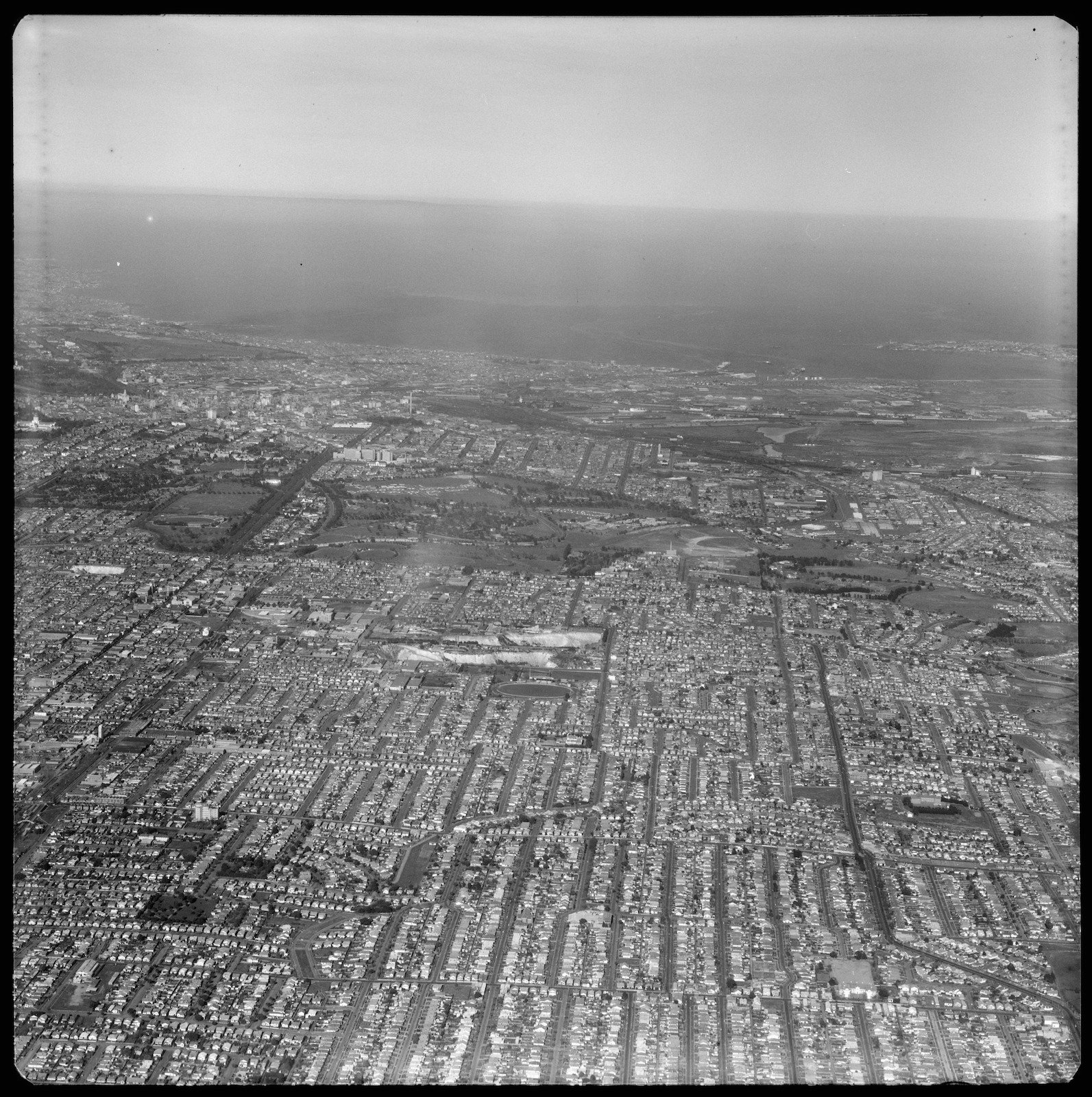
High altitude view. Brunswick. All west Brunswick to the Bay from Reynard St. Coburg. Port Phillip in the background.

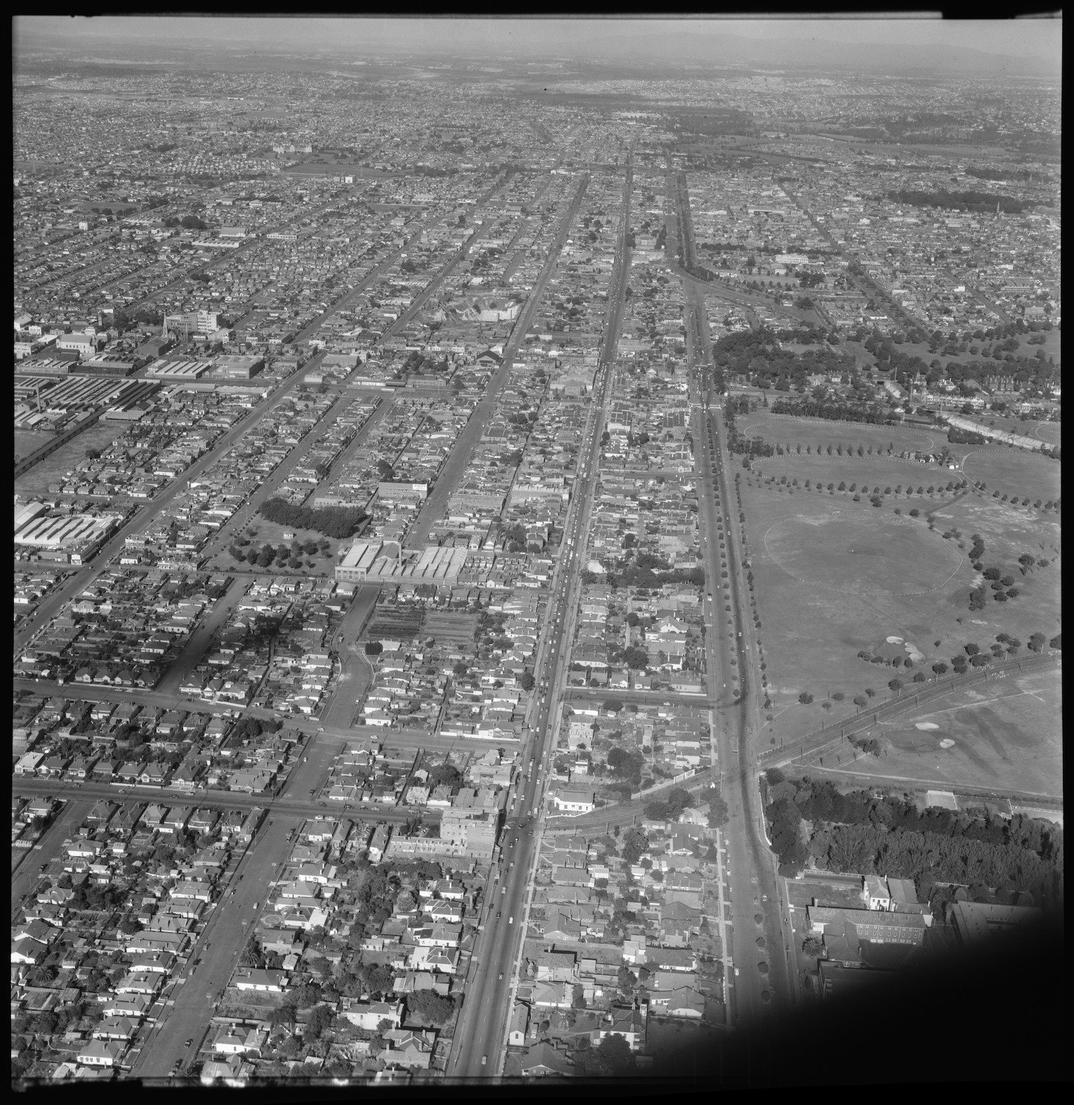
Aerial view of Brunswick 1940-50 - Looking south east over Moreland Road and Moreland Railway Station
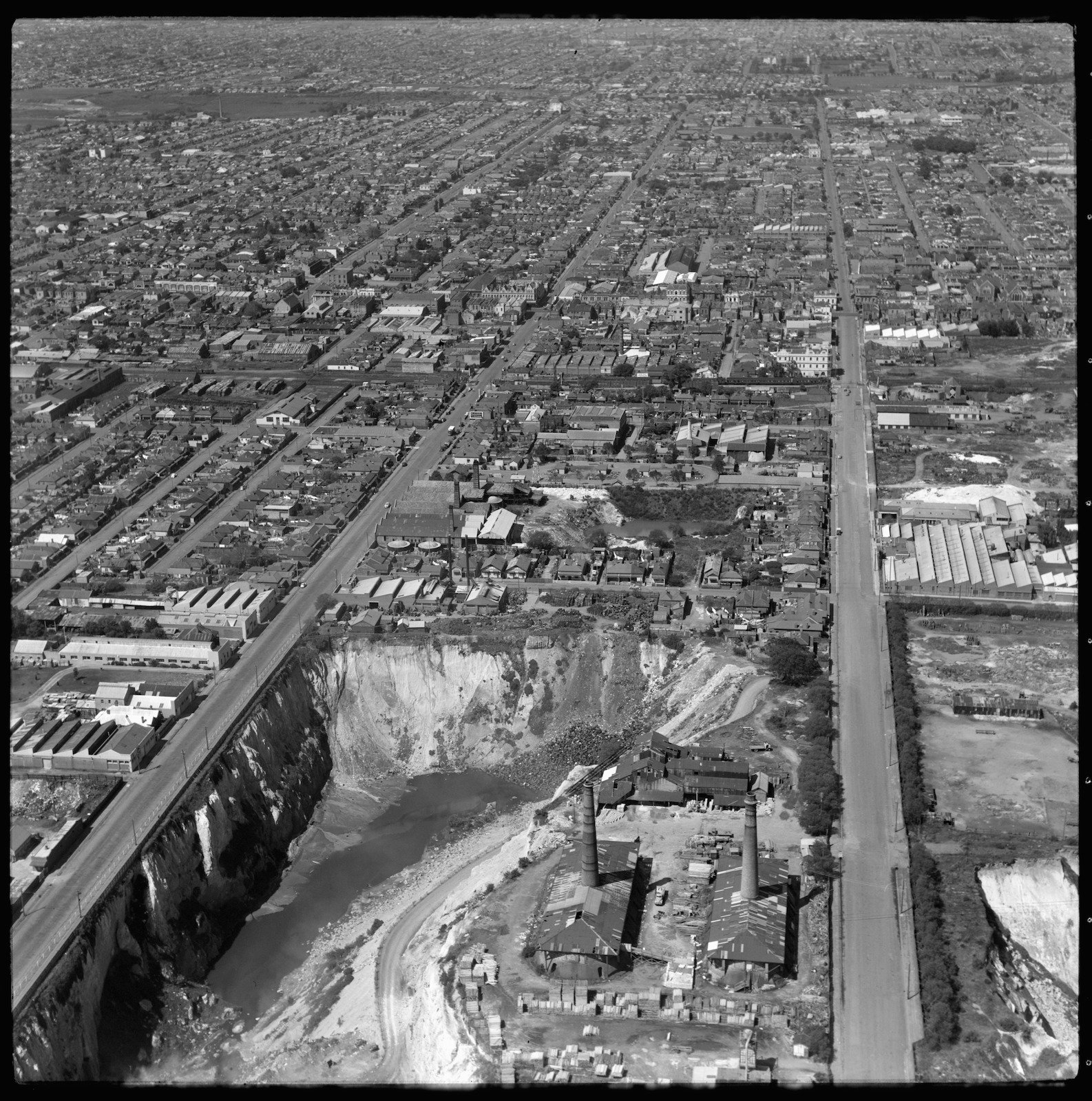
Aerial view looking east, almost directly overhead with brick quarry, factories and smoke stacks in foreground. Quarry bordered by Albert and Victoria Streets. Quarry now developed as Clifton Park.
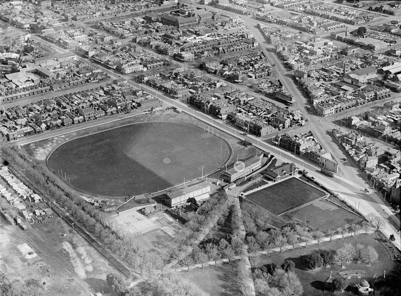
The intersection of Brunswick Street and St. Georges Road, North Fitzroy, showing Brunswick Street Oval 1925-40 (View from the Edinburgh Gardens and the oval looking south east)
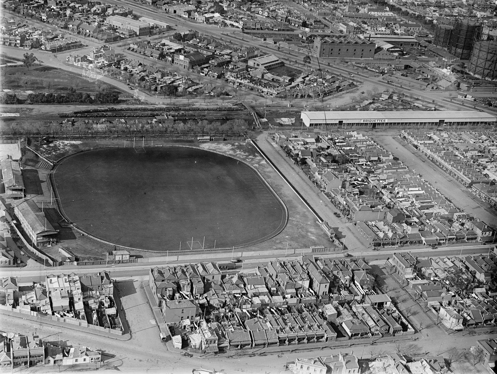
Football ground in Brunswick Street North Fitzroy now known as Fitzroy Community Oval - ca. 1925-35
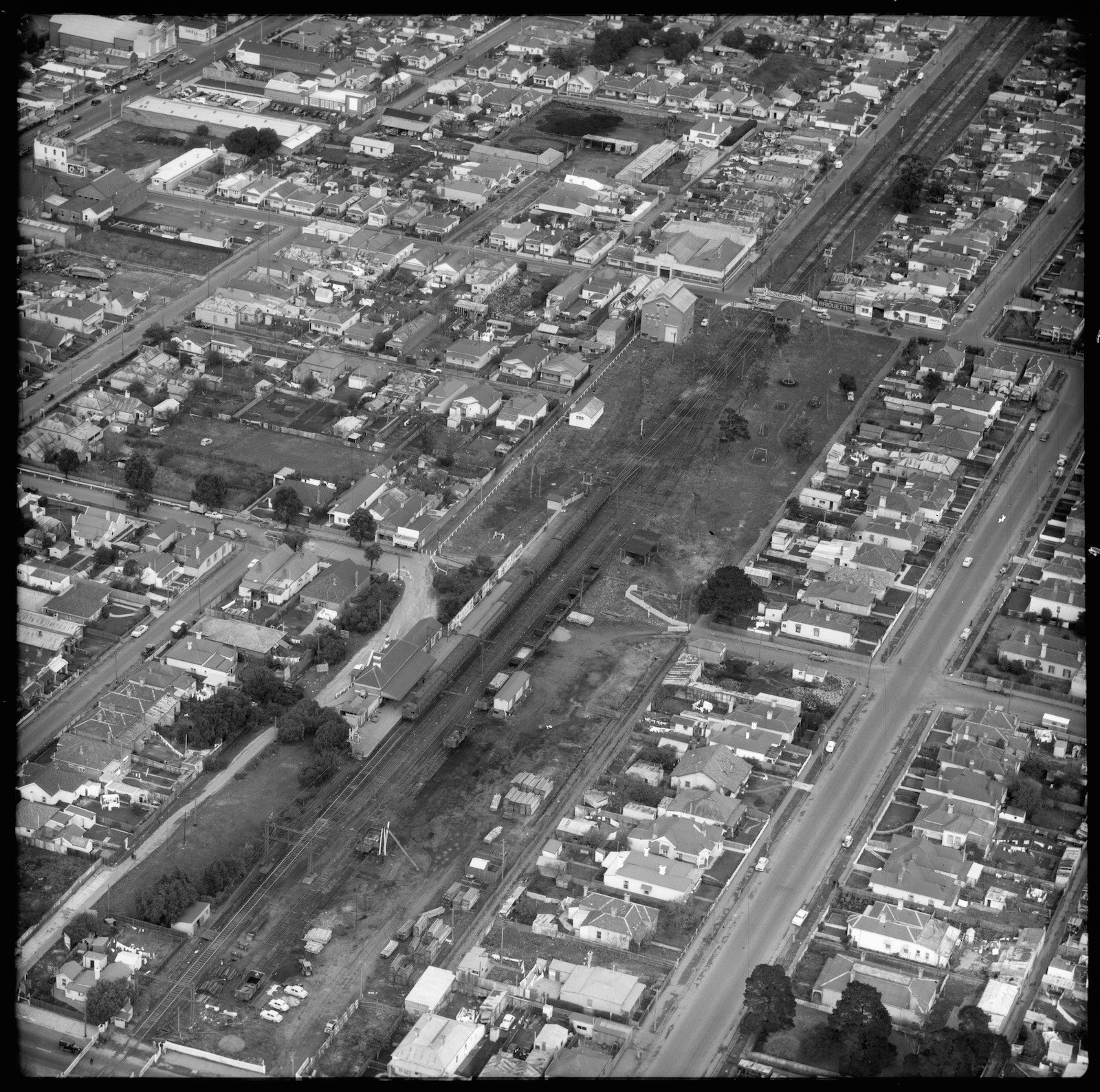
1957 Aerial view of Brunswick Railway Station, Victoria, looking north east ($40 copyright fee applies)

1954 Aerial view over Brunswick and Moonee Ponds, Victoria

1956 Aerial view looking south along Sydney Road, Brunswick ($40 copyright fee applies)