Williamstown Unrestored
Step back in time with our collection of raw historic pieces, each one a potential candidate for digital restoration, printing, and framing. Should you find something captivating for your home, simply place the custom order through our Custom Order Product with our online store. Just copy the title below the desired item, and the listed prices already include the restoration fee. For further inquiries and customisation options, don't hesitate to reach out to us via our Contact form.

City of Williamstown list of fares for the short road ferry 1926
City of Williamstown, Parish of Cut Paw Paw. Crown Lands and Survey 1930 - NOW AVAILABLE IN OUR STORE

Plan of land at Williamstown 1856 Albert Street Queent Douglas Russell Place
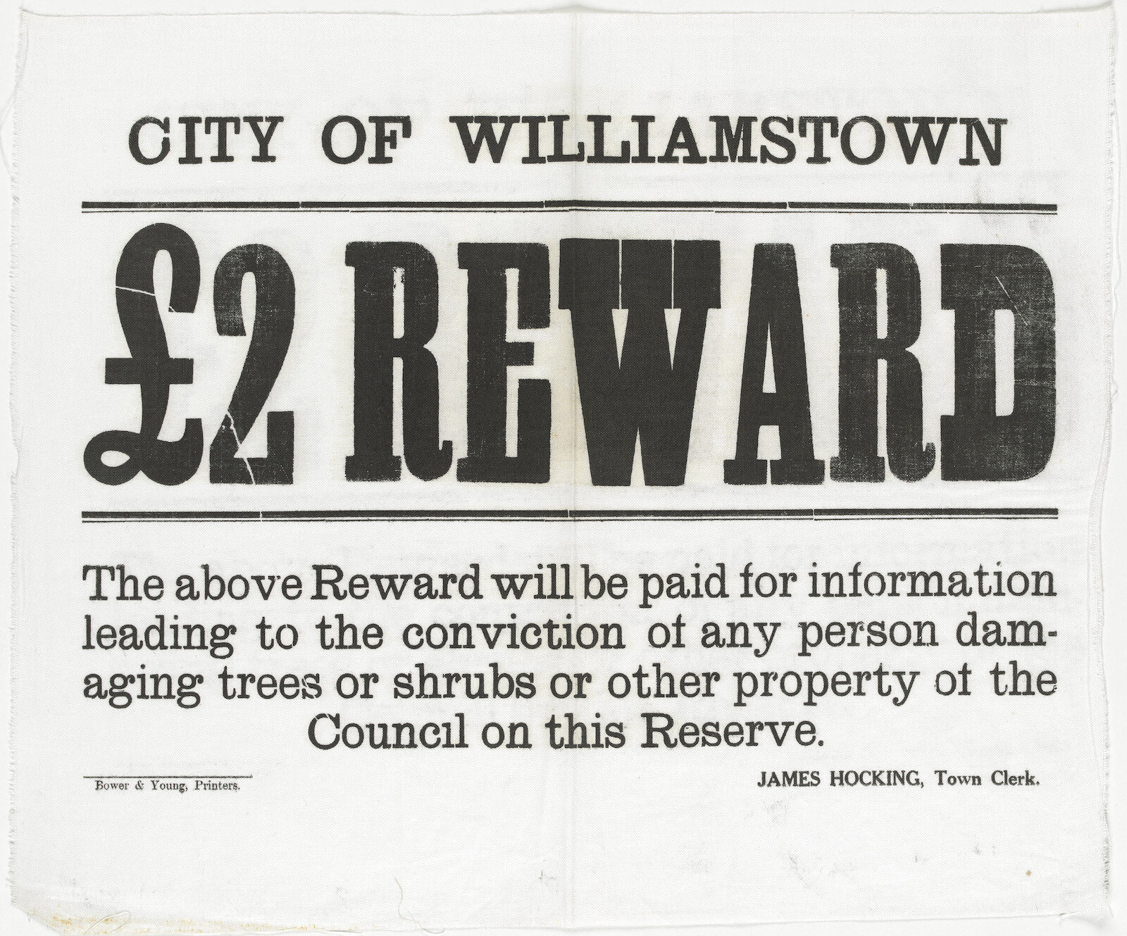
Notice from the City of Williamstown offering £2 Reward 1920-1930
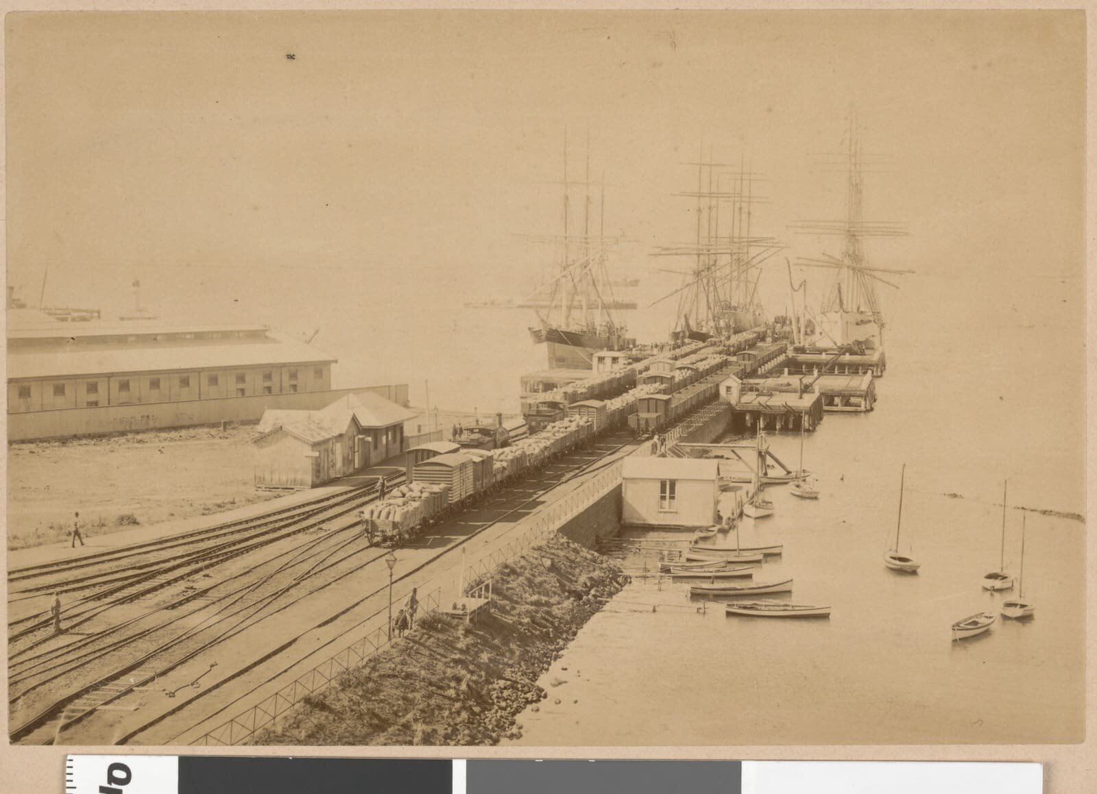
Railway Pier Williamstown Australia 1885

Boats moored at Fisherman's Jetty Williamstown 1910

Plan of Williamstown, County of Bourke surveyor General's Office, Melbourne Novr. 20th 1855

Plan of Williamstown, County of Bourke Nov 20th 1855

Special lands near the junction of Geelong and Williamstown railways, County of Bourke Office of Lands and Survey 1864.

Subdivision about 4 miles W from Williamstown near Kororoit Creek, County of Bourke 1855

Williamstown County of Bourke Department of Crown Lands and Survey 1910 No. 1

Williamstown County of Bourke Department of Crown Lands and Survey 1910 No. 2

Williamstown, County of Bourke Department of Crown Lands and Survey 1881
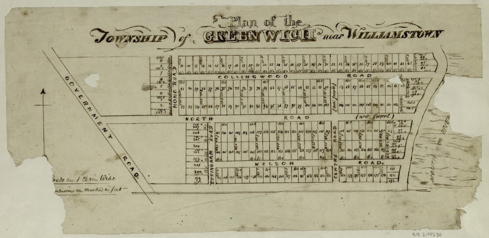
Plan of Greenwich near Williamstown 1850s

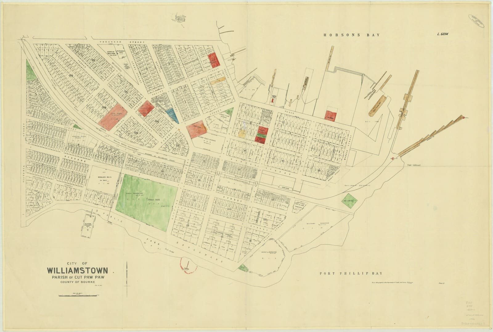
Williamstown, Fort Gellibrand, Parish of Cut Paw Paw, county of Bourke 1942

Patent slip Williamstown 1861
Williamstown showing dockyard and port 1925-40
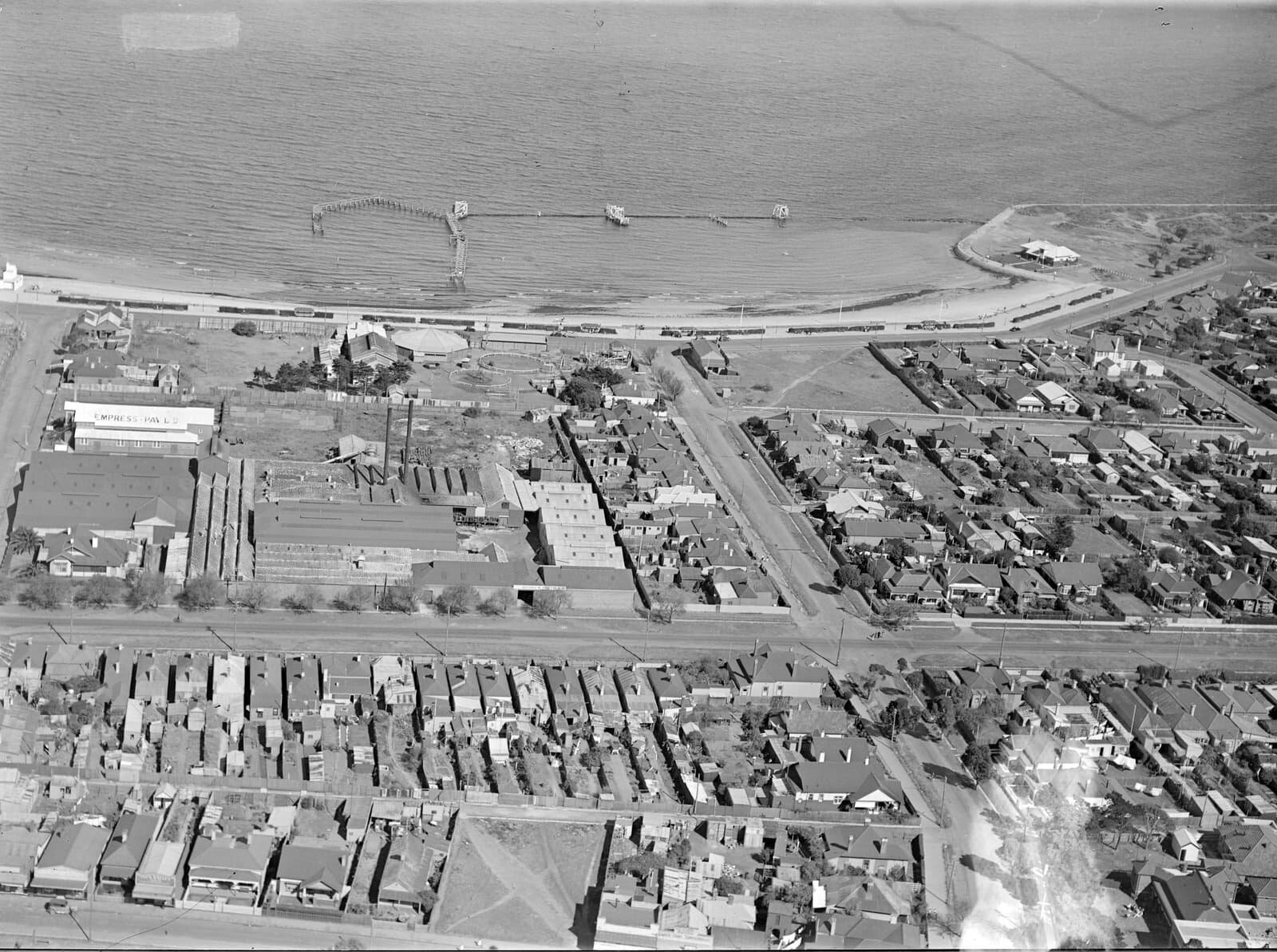
Williamstown Beach, The Esplanade 1930s
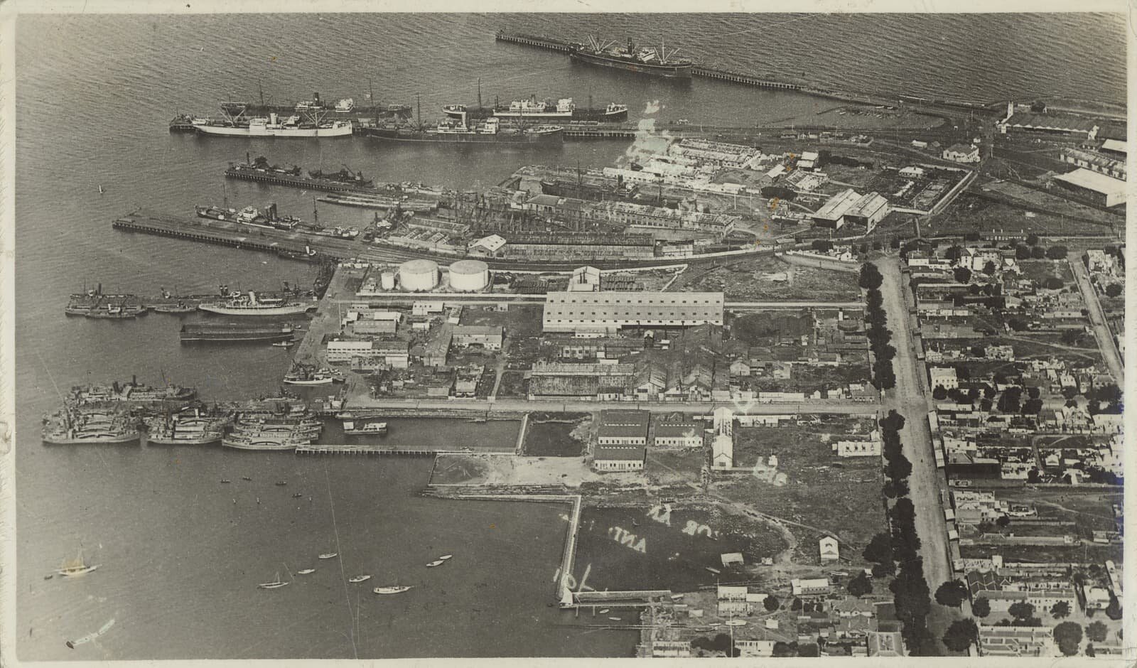
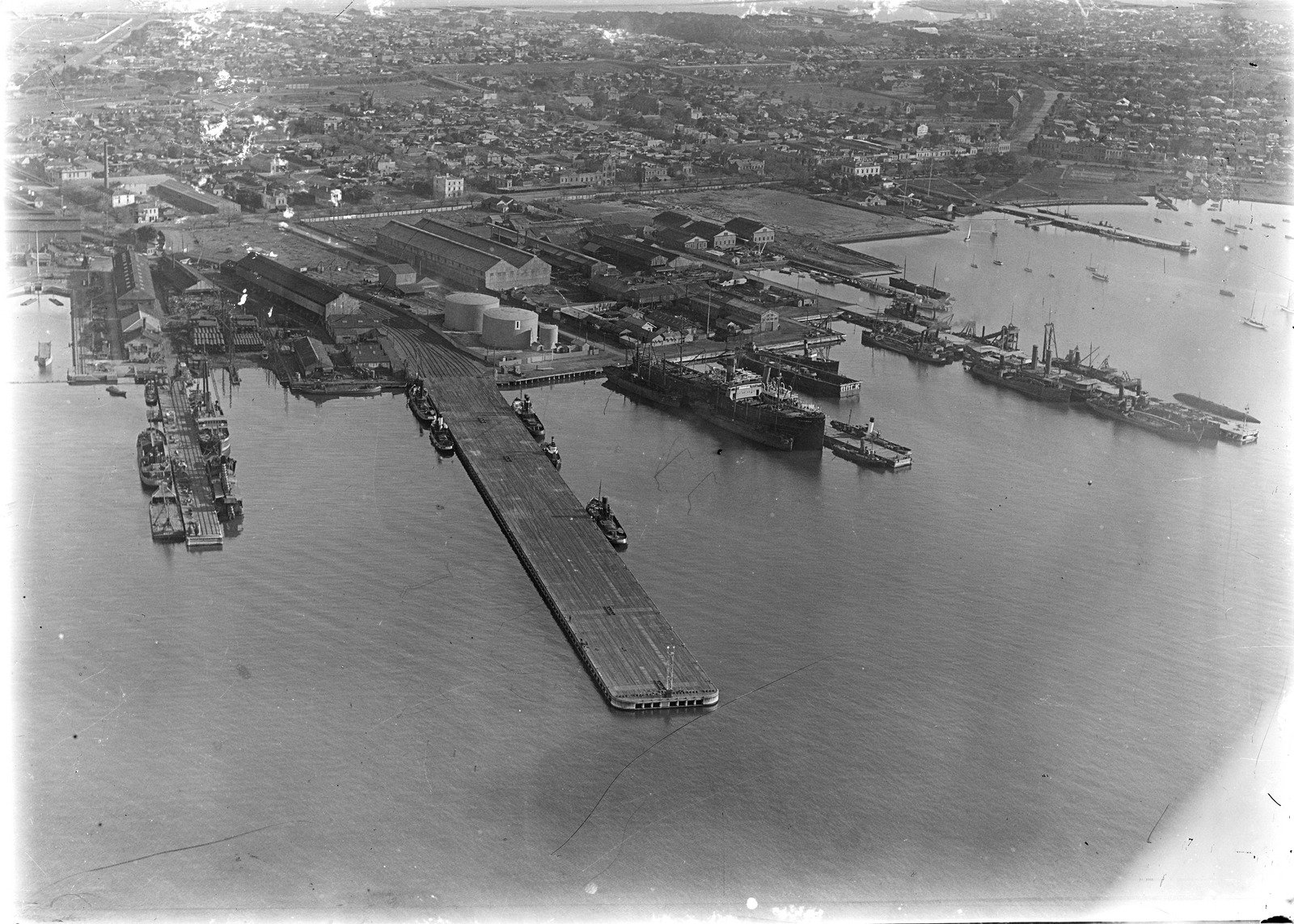
Williamstown Docks Aerial 1920
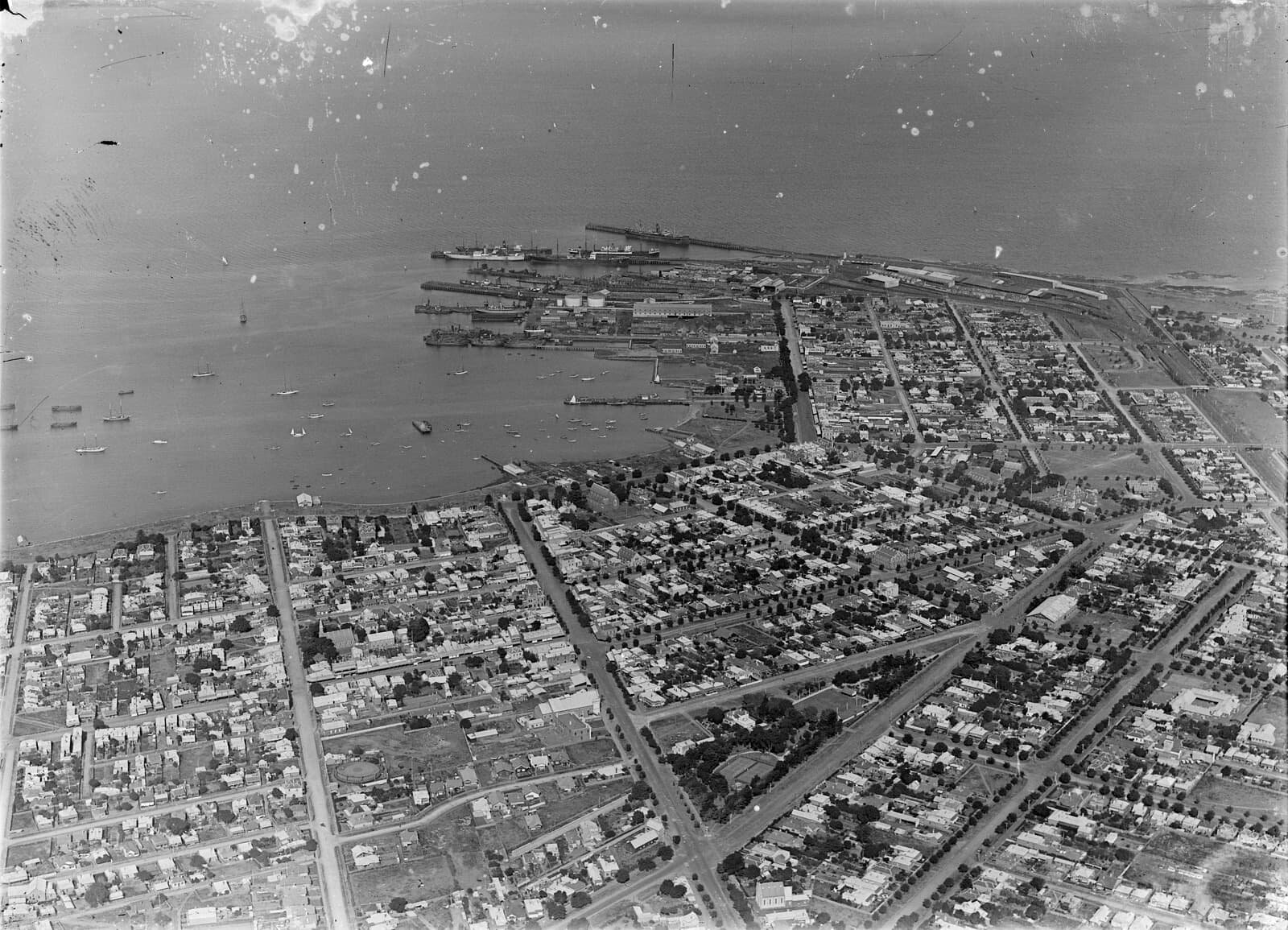
Williamstown Aerial 1926
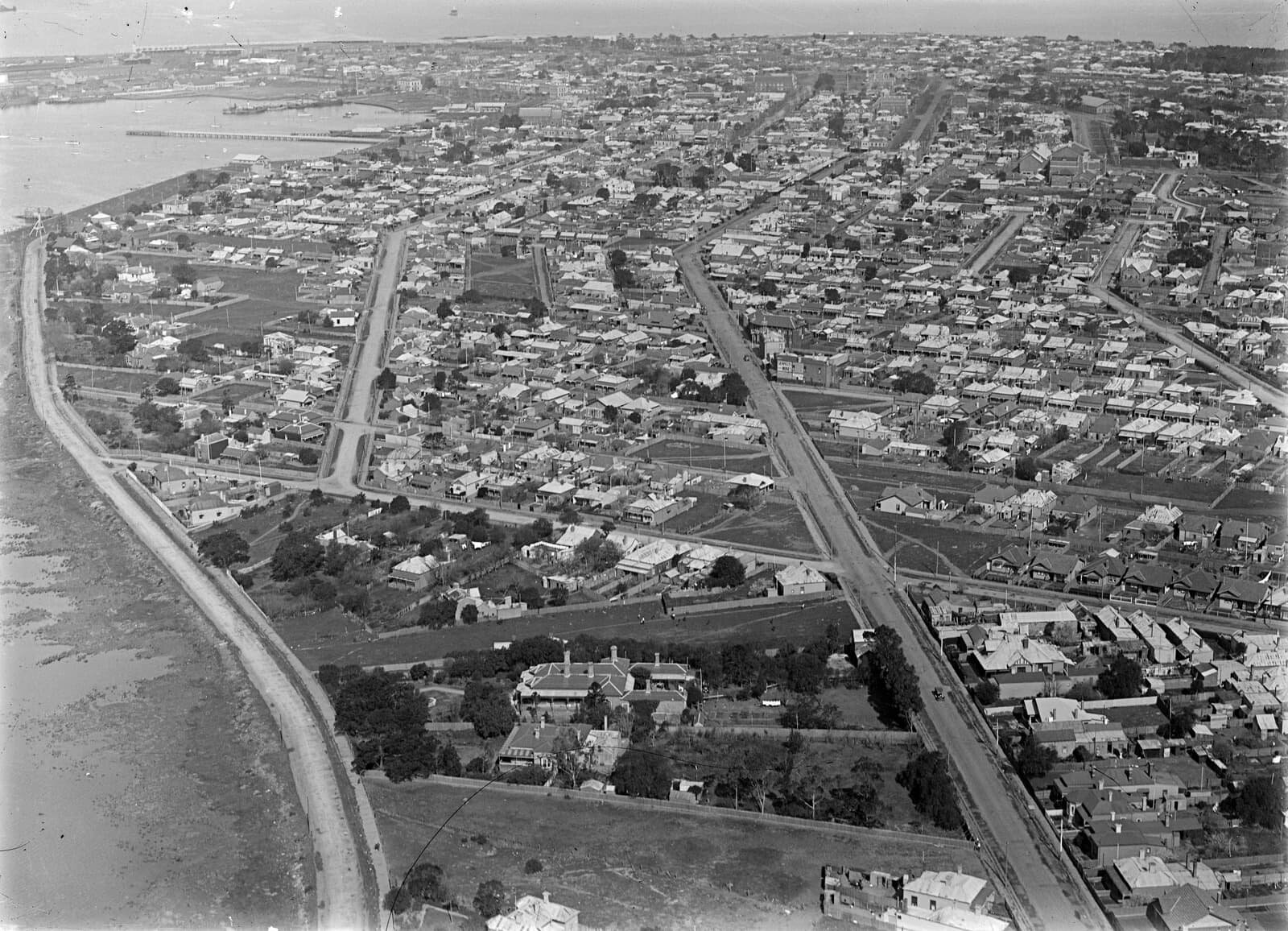
Williamstown Aerial 1926 - NOW AVAILABLE IN OUR STORE
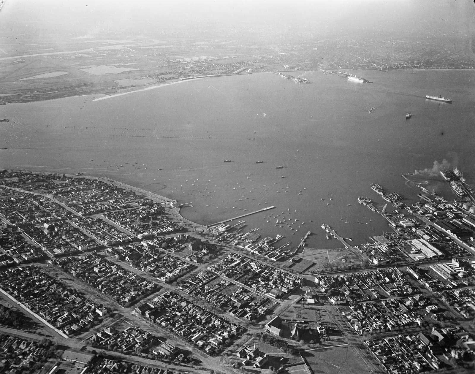
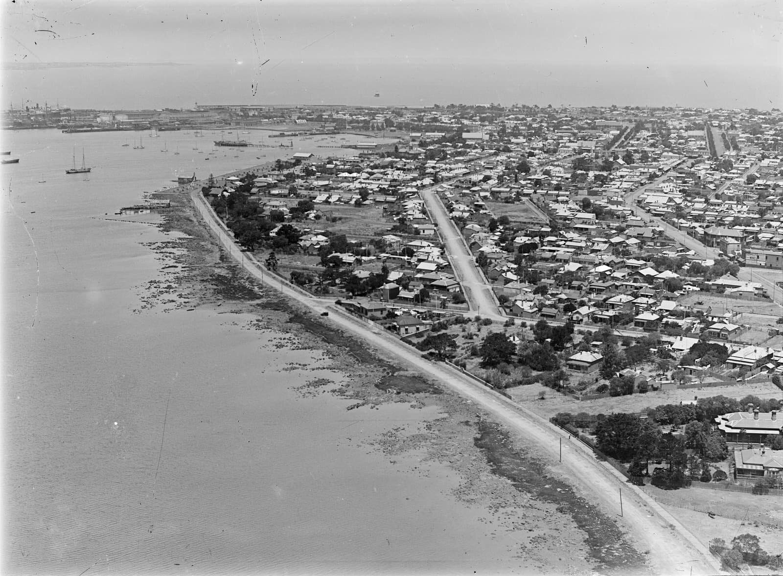
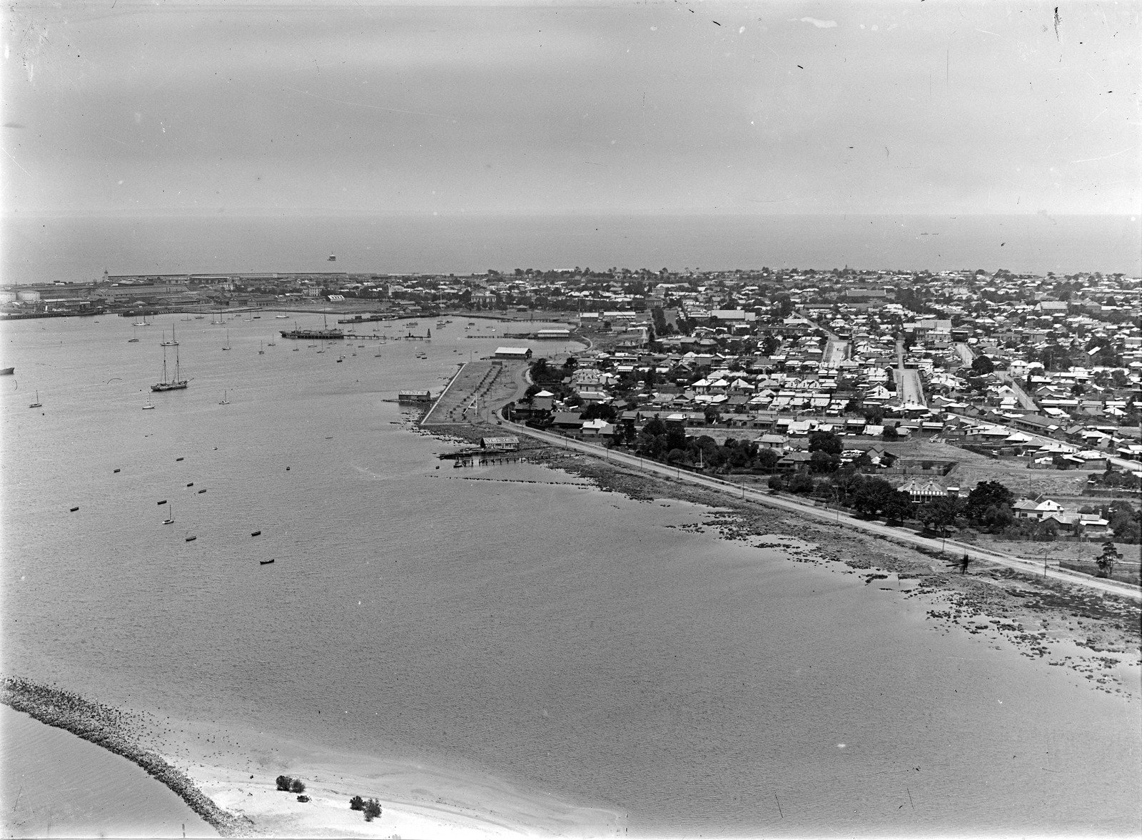
Aerial view of Hobsons Bay and Williamstown. 1940s - NOW AVAILABLE IN OUR STORE
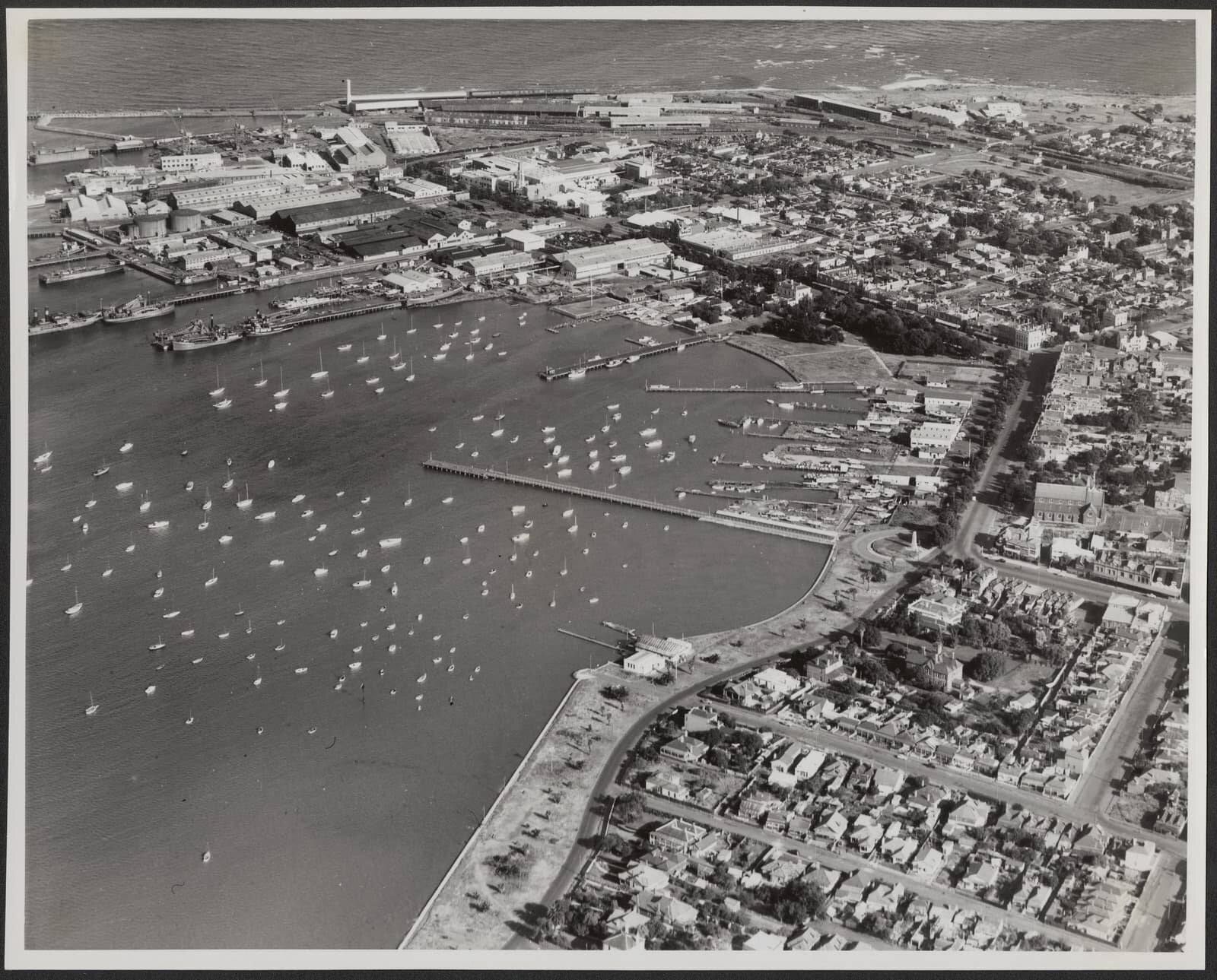
Aerial view of Williamstown 1950s - NOW AVAILABLE IN OUR STORE
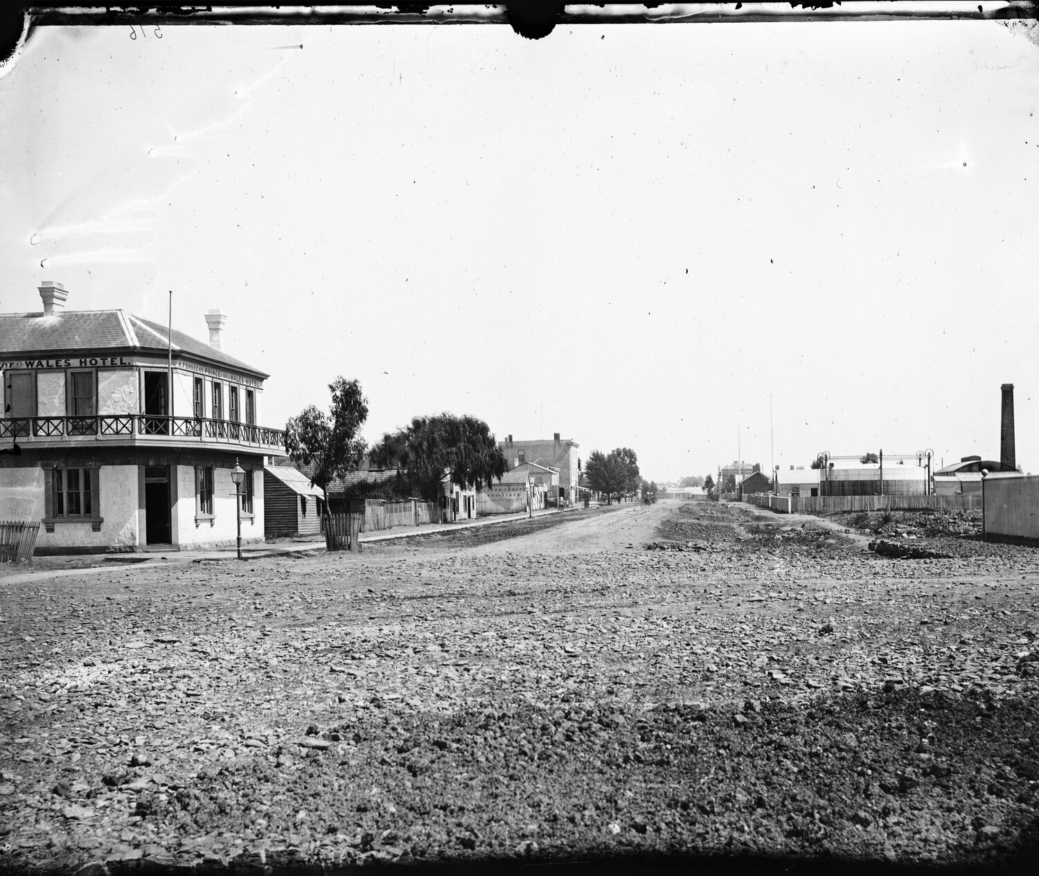
View along Nelson Place, Williamstown in the early 1870s from the Prince of Wales Hotel (now Titanic Theatre Restaurant). A building with a Georgian design featuring a cast-iron verandah
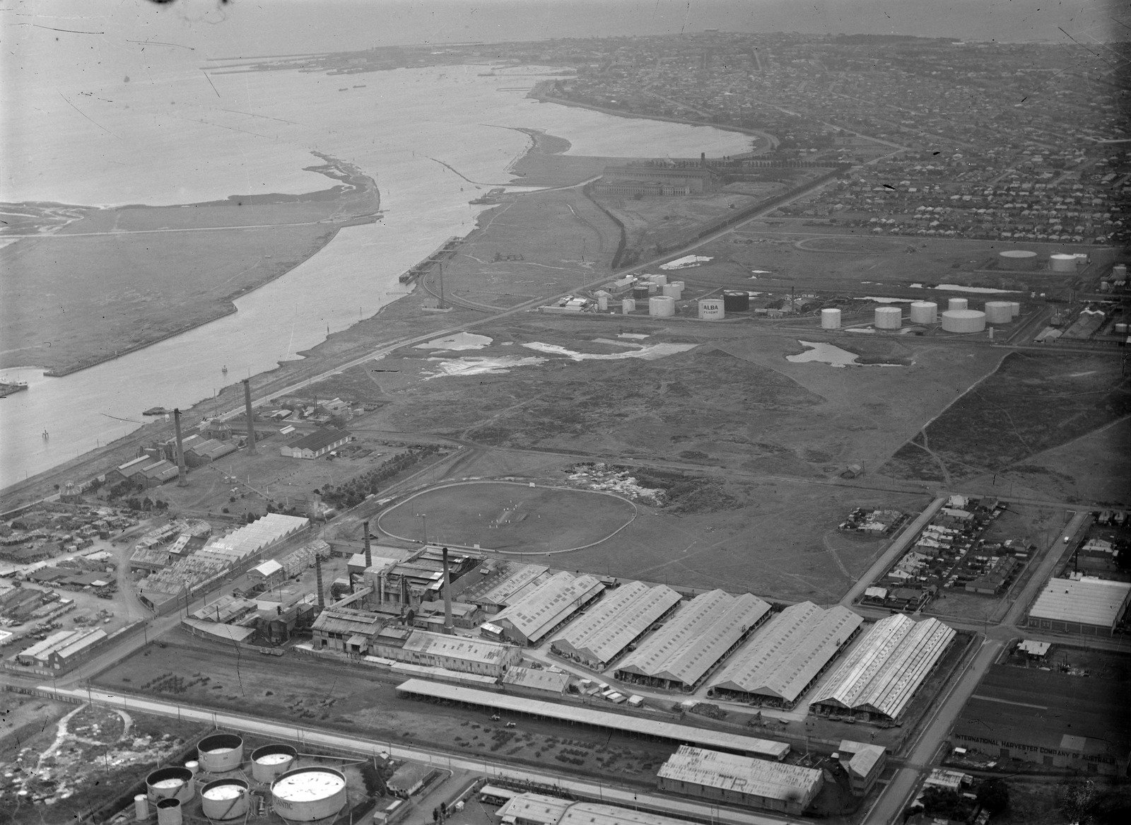
Aerial over Industrial Spotswood, looking towards Williamstown 1940s

Williamstown Aerial 1926 - showing racecourse and railway on Point Gellibrand
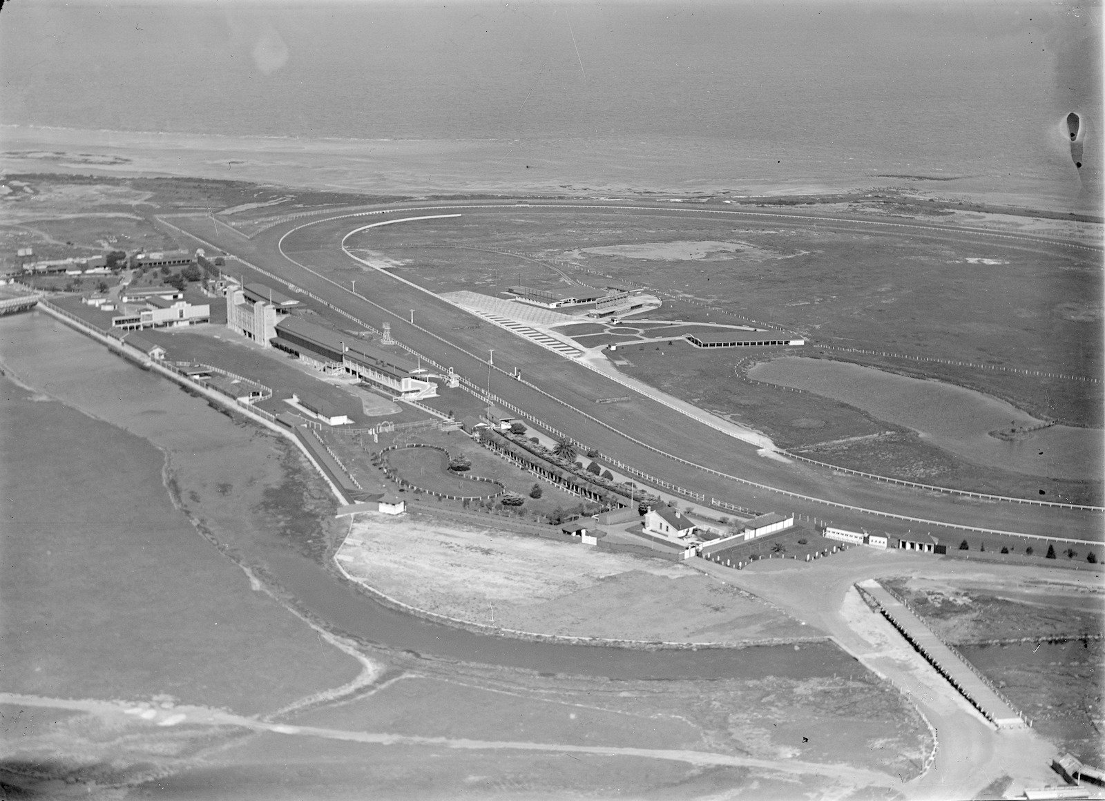
Williamstown Racecourse - 1920-40
Williamstown Aerial 1926
Port of Williamstown 1933

Williamstown Newport aerial view. Showing part of a bay and river, with paddocks in background, industrial and residential subdivisions in foreground 1930-50

Spotswood looking towards Williamstown 1930-40s